|
Did you know? Beaver Lake Fun Facts!
by David Casaletto, OWW Executive Director
I was attending a Beaver Lake LakeSmart meeting a few weeks ago. LakeSmart is a program offering free education and training to lakeside residents about how to live next door to the lake in harmony with nature. The first part of the class gave some facts about Beaver Lake, some that I did not know, so I thought it would be fun to share them with you, too. I also used information from the US Army Corps of Engineers.
Beaver Lake
Beaver Lake is a man-made reservoir that was formed by a dam across the White River. Beaver Lake is the first in a series of U.S. Army Corps of Engineers reservoirs on the White River in Arkansas and Missouri. The headwaters originate in the Boston Mountains in Franklin County, Arkansas. The Beaver Lake watershed is located in the Ozark highlands of northwestern Arkansas in Benton, Carroll, Washington and Madison Counties.
The authorized purposes of Beaver Lake are flood control, generation of hydroelectric power and public water supply. Other allowed uses are recreation and fish & wildlife. Protection of the water quality in Beaver Lake is extremely important as 1 in 8 Arkansas residents use Beaver Lake water as their public water supply. Beaver Lake's watershed is rapidly changing. Economic forecasters predict that more than 800,000 people will populate Benton and Washington counties by the year 2025, and as many as 1.2 million people will be living in Northwest Arkansas by 2050.
With growth comes increased pressure on the watershed and the lake. We know from current research that the upper third of Beaver Lake has an overabundance of algae. We know also that during certain seasons, the bottom layers of the lake are depleted of oxygen and that the lake becomes extremely turbid after storm events. Our lake cannot take care of itself. All of us are part of the problem and all of us must be a part of the solution. It will take the combined efforts of children, adults, teachers, developers, engineers, accountants, farmers, politicians and all citizens to accomplish this vital task.

Testing drinking water at Beaver Water District
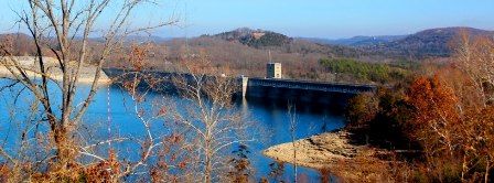
Construction of the Beaver Lake dam began in November 1960 and was completed in June 1966 at a cost of $46.2 million dollars. The dam is 2,575 feet long and is 228 feet above the streambed. There are 748,000 cubic feet of concrete in the dam.
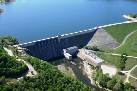
Beaver Lake dam
When Beaver Lake is at the top of the flood-control pool the elevation is 1,130 feet, the surface area is 31,700 acres and the shoreline length is 483 miles. The lake total storage capacity is 1,952,000 acre feet of water. Here is where is little further explanation is needed. An acre foot is the amount of water needed to cover an acre of land one foot deep. My online search tells me an acre foot equals 325,851 gallons of water so using my handy calculator, there are over 636 billion gallons of water in the lake!
To reduce damage caused by flooding, the dam is is operated with the other lakes in the White River system to reduce the frequency and severity of floods. The runoff from storm events is captured and stored until rivers downstream begin to recede. Then the stored water is released in a controlled manner according to a pre-determined plan so as not to exceed pre-determined river stages downstream.
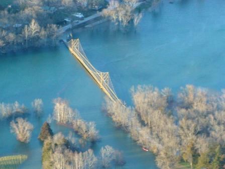
Suspension bridge at Beaver, AR during 2008 flood event.
Just a few miles downstream from Beaver Lake dam.
While recreation is not one of the authorized uses on the lake, it is definitely allowed! The lake is the destination of more than 2.4 million visitors a year that include boaters, fishermen, picnickers, swimmers, scuba divers, campers and just those who sit on the shore and admire the Ozarks beauty!
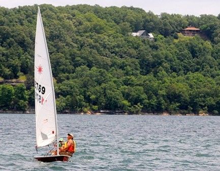
Boating on Beaver Lake
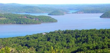
Beaver Lake, towering limestone bluffs, natural crevices, a wide variety of trees and flowering shrubs, and a diversity of wildlife and birds, make it easy to see why it is called the "Jewel of the Ozarks"!
|