 |
|
|
Technology Provides Scientists a Bird's Eye View
|
Researchers use planes and satellites to stay on top of oil spills
 | |
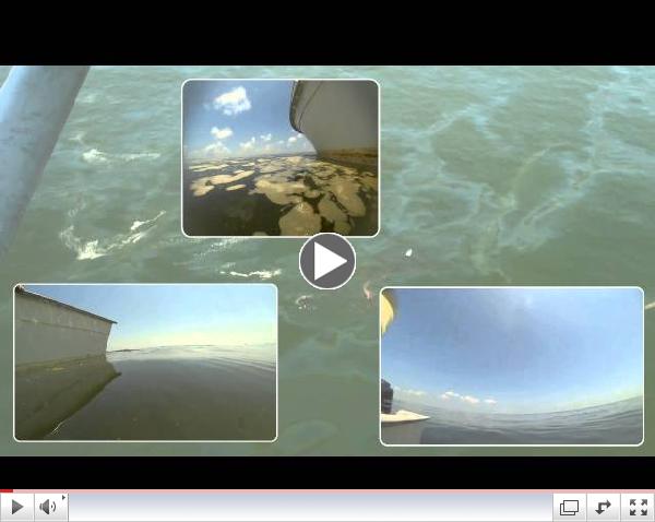
Video: Underwater thickness comparison
|
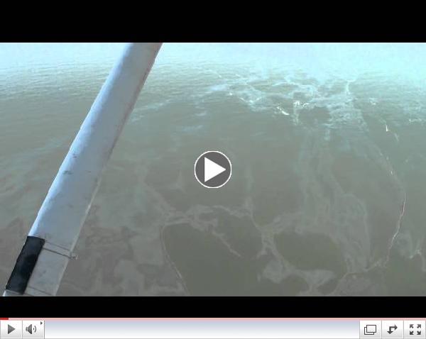
During a recent expedition in the Gulf of Mexico to collect oil-emulsions and heavy thick oil samples from an oil slick, a team of Deep-C scientists on board a sampling boat were aided by overflight operators on a plane. This helped direct the sea level scientists toward specific areas of the slick and assisted them in identifying the different oil types they were looking to sample. In a series of videos recorded during that mission, you can see how this effort to find and collect sea water contaminated with oil can be much more effective when assisted by a view from above.
 | |
High Altitude Flyover the oil slick
|
"To observe the oil from sea level you literally have to be on top of it," notes Oscar Garcia-Pineda, Deep-C scientist and research faculty at Florida State University. "It is difficult to see oil at sea level, even when it is very thick and only a hundred or so feet from your vessel. You often won't see it unless somebody from the air is helping you."
And to take this top-side detection method one step further... at the same time they were collecting samples aboard the research vessel, the scientists were acquiring satellite images collected via remote sensing satellites (ie, Radarsat, TerraSAR, EO-1, and Landsat).
 | |
Radarsat-1 (Illustration: NASA, Wikimedia Commons)
|
"Remote sensing techniques allows us to detect oil spills immediately," explains Garcia-Pineda. "This includes detection of oil using aerial imagery and spacecraft satellites using a wide suite of sensors (hyperspectral and microwave) to locate and characterize the properties of floating oil."
One of the main goals of Garcia-Pineda's oil spill research is to "fingerprint" different oil types on satellite imagery in order to understand the real spectral signatures, and then to correlate this with the in situ observations. Garcia-Pineda is excited about the potential for using overhead and remote sensing techniques to improve response time in the immediate aftermath of an oil spill or slick.
"In fact, at FSU we are developing our own sensor technology which we envision can be used on small Unmanned Aerial Systems (UAS) also know as drones," Garcia-Pineda explains. "The radar antennas we are working on have great potential for operational applications during oil spill surveillance. Having a UAS such a quadcopter rigged with infrared and SLR video cameras available during field missions would allow scientists to better target sampling and recovery efforts."
Reference: Garcia-Pineda, O., MacDonald, I., Hu, C., Svejkovsky, J., Hess, M., Dukhovskoy, D., et al. (2013). Detection of Floating Oil Anomalies From the Deepwater Horizon Oil Spill With Synthetic Aperture Radar. Oceanog., 26(2), 124-137.
|
|
|
Deep-C Scientists Make Rare Discovery in the Gulf
|

Researchers find species of phytoplankton never before recorded
in the Gulf of Mexico
.
 Navilithus altivelum Navilithus altivelum is a rare deep photic species recorded only once in literature by Jeremy Young from samples he took off the coast of Java in the Indian ocean. So it was quite a surprise for Deep-C scientists working in the Gulf of Mexico to come across the same rare species in their samples collected during a research cruise. These scientists are investigating the effects of the 2010 Deepwater Horizon oil spill on microscopic life in the Gulf of Mexico. They are also measuring the abundance and building a census of nanoplankton communities in the Gulf, whose role at the base of the food chain is essential."This find is particularly interesting because it brings to light how rare and diverse some of these oligotrophic species are," says Jarrett Cruz, a graduate student working with Dr. Sherwood Wise, professor and marine geologist at Florida State University. "This is the first recorded observation of this species in the Western hemisphere!"
|
|
|
|
The Immediate Aftermath of an Oil Spill
|
New findings from a field experiment carried out in the North Sea provide valuable insight into the fate of oil during an oil spill
 | |
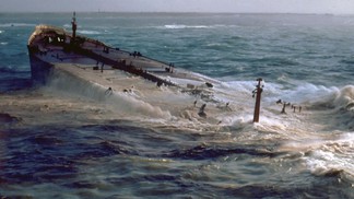
© wikimedia commons - Amoco Cadiz (1978)
|
The fate of oil during the first day after an accidental oil spill is still poorly understood, with researchers often arriving on the scene only after several days. New findings from a field experiment carried out in the North Sea provide valuable insight that could help shape the emergency response in the immediate wake of disasters.
It is well known that oil and water don't mix. Less well known is the fact that when petroleum is spilled onto a water surface, a fraction of the oil immediately begins to evaporate into the air or dissolve into the seawater. These dissolved toxic hydrocarbons can threaten aquatic species, while evaporated compounds may pose a risk to rescue workers or populations downwind of an accident site. Publishing in the journal Environmental Science & Technology, a team of European and American researchers report on a unique study focused on the fate of hydrocarbons during the 24 hours that follow an oil spill.
Following a spill, oil suddenly finds itself in a radically new environment -- exposed to light, air, and the water surface after millions of years underground. "In its new environment, the oil immediately begins to change its composition, and much of that change happens on the first day," explains Samuel Arey, a researcher at EPFL and Eawag in Switzerland and corresponding author of the study. Oil is a complex mixture of many hydrocarbon compounds. Certain volatile compounds evaporate within hours, contaminating the overlying atmosphere. Others, such as toxic naphthalene, simultaneously dissolve into the seawater, posing a threat to aquatic life. Especially since the Exxon Valdez catastrophe in 1990, which released over 40,000 cubic meters of oil into the ocean, researchers have sought to evaluate to what extent marine species in the vicinity of an oil spill are exposed to toxic hydrocarbons. But this question has largely remained debated, because many of the hydrocarbons are dispersed into the water or the overlying air well before scientists arrive at the site.
In order to collect data on the immediate aftermath of an oil spill, the researchers collaborated with emergency response specialists of the Dutch Rijkswaterstaat to recreate a four cubic meter oil spill in the North Sea, in a shipping zone already burdened by pollutants, 200 kilometers off the coast of the Netherlands. By studying this relatively small oil release, they were able to gain a better understanding of what goes on in much larger spills, with findings that could be useful to assess the risks to underwater life, as well as to emergency response team workers at the sea surface.
No two oil spills are alike. Aside from the sheer volume of oil released onto the sea surface, the environmental impact of an oil spill depends on external factors, such as the wind, waves, and the temperature of the air and the water. The North Sea experiment, for instance, was carried out on a summer day with two-meter high waves. Within just over a day, the surface oil slick had almost dissipated. On a cooler day with less wind and smaller waves, the slick would have likely persisted longer.
Thanks to a computer model that was tested against the data collected in the North Sea, the researchers are now able to extrapolate their findings to larger spills and other environmental conditions. Results from the study will provide the researchers with tools to better assess the immediate impact of future disasters on humans and on the environment, as well as to plan the emergency response, even in settings that differ strongly from those encountered in the North Sea.
The research was carried out in partnership with the Royal Netherlands Institute of Sea Research, the Dutch Rijkswaterstaat, the University of Lausanne in Switzerland, the Helmholtz Center for Environmental Research in Leipzig, Germany, and Deep-C scientists at the Woods Hole Oceanographic institution in Massachusetts, USA.
Reference: Gros, J. J., Nabi, D., Wurz, B., Wick, L. Y., Brussard, C. P. D., Huisman, J., et al. (2014). The first day of an oil spill on the open sea: Early hydrocarbon mass transfer fluxes to air and water. Environ. Sci. Technol., in press.
|
|
|
The Ocean in Motion: Modelling Surface Waves
|
Study provides insight into how oil is transported by ocean waves
 A recent study investigated how surface waves contribute to the fate of plankton. For the numerical modelling experiment, Deep-C researchers picked an example particle and region that is accessible for measurements in the field, and easy to model -- Northeast Arctic Cod eggs and larvae. While some of the results are specific for this species, the main results apply to all buoyant particles in the upper ocean (i.e. plankton and oil droplets) and to all regions wherever surface waves are present. By considering wave effects for particle transport and vertical mixing, the Deep-C researchers found that waves modified the fate of cod eggs by moving the buoyant particles closer to shore in the long term. They hypothesize that this mechanism also acts to concentrate biomass and pollutants, increasing their contact rates. Breaking waves are also responsible for mixing particles downwards, thereby flattening the vertical profile of particle concentrations. Understanding the involved processes for transport of plankton and oil in the upper ocean will hopefully serve our efforts to model oil spill accidents and impacts on the ecosystem.
Reference: Rohrs, J., Hakon Christensen, K., Vikebo, F., Sundby, S., Saetra, O., & Brostrom, G. (2014). Wave-induced transport and vertical mixing of pelagic eggs and larvae. Limnol. Oceangr., 59(4), 1213-1227.
|
|
|
Deep-C Sponsors Two NOAA-NGI Interns
|
Research internships provide on-the-job learning experiences for students
Each summer, exciting scientific internships are available in a variety of fields studied by National Oceanic and Atmospheric Administration (NOAA) and Northern Gulf Institute (NGI) scientists including coastal science, fisheries management, climate change, ecosystem management, engineering and socio-economic data analysis. The NOAA-NGI Diversity Internship Program offers students from all scientific disciplines (including biological, physical, environmental, information, computer and social sciences as well as environmental justice), as well as education and engineering, are eligible for these competitive positions.
"Selected students work side-by-side with leading scientists and experts in their fields at their respective research institutions and laboratories," says Dr. Tina Miller-Way, Internship Program PI and Chair of the Discovery Hall Program at the Dauphin Island Sea Lab (DISL). "These internships offer a unique opportunity for on-the-job learning and enable students to explore career opportunities that match their academic and personal interests."
The NOAA-NGI Diversity Internship Program has been in existence since 2008: DISL has been the home of the program since 2010. To date, the program has hosted 64 interns at 18 locations across the northern Gulf.
This summer, the Deep-C Consortium is supporting two students selected for participation with scientists Drs. Richard Snyder (University of West Florida) and James Nienow (Valdosta State University) acting as their mentors and facilitating the interns' research:
 Cynthia Kane (at left) interning at the University of West Florida used several microbiology techniques including polymerase chain reactions (PCR), gel electrophoresis, and clonal library creation to analyze water and sediment samples collected from the Gulf of Mexico to determine the different types of Archaea present. To learn more, read Cynthia's blog.  Chris Horruitiner (at right) interned at Valdosta State University (GA) to investigate the impacts of the Deepwater Horizon event on the phytoplankton populations in the DeSoto Canyon region of the northern Gulf of Mexico. Chris used a combination of net plankton samples (across the entire water column), pigment samples (for HPLC), and discrete Niskin bottle water samples from several depths across the water column analyzed using SEM and imaging flow cytometry to address how phytoplankton populations change with depth and with season in this area. To learn more, read Chris' blog. NOAA-NGI internships last 10 weeks and are open to undergraduate and graduate students currently enrolled in a degree-granting program. There is an emphasis on selecting students from communities and institutions in the northern Gulf of Mexico region, and individuals from demographic groups underrepresented in the NOAA workforce are especially encouraged to apply. Visit the DISL website for information about future NOAA-NGI internship opportunities.
|
|
|
 |
|