Dear Florida Climate Center Friends,
We'd like to present you with the December 2013 edition of our newsletter. In this newsletter, you'll find our monthly climate summary, a list of special events that our staff attended, an example of a data request made to the office, and more. If you have any questions, please email us at climate@coaps.fsu.edu.
Thanks,
The Staff of the Florida Climate Center
 |  |  | David Zierden
State Climatologist | James O'Brien
Professor Emeritus | Melissa Griffin
Asst. State Climatologist |
|
November Climate Summary for Florida
|
|
2013 Hurricane Season Review
November 30th marked the official end to the 2013 Hurricane Season. This hurricane season had the fewest number of hurricanes since 1982, with only 13 named storms. Only two of those (Ingrid and Humberto) became hurricanes, and only one storm (Tropical Storm Andrea) made landfall in the U.S. The forecasts at the beginning of the season predicted a very active season, but the number of actual hurricanes and major hurricanes were well below normal.
To find out more about the season, you can read the official press release from NOAA at:
http://www.noaanews.noaa.gov/stories2013/20131125_endofhurricaneseason.html
In addition, the National Hurricane Center will be putting together Tropical Cyclone Reports for all of the 2013 storms. Once they have finalized an in-depth report on an individual storm, it will be posted on the following website:
http://www.nhc.noaa.gov/2013atlan.shtml
|
|
State Climatologist Briefs FSU's Department of Earth, Ocean and Atmospheric Science
State Climatologist David Zierden presented an hour-long seminar to FSU's Department of Earth, Ocean and Atmospheric Science on November 21st. The seminar covered a summary of the extraordinarily rainy summer this year in the Southeast and the large-scale patterns that made it possible. He also presented on the current state of the Pacific Ocean and what that means for the upcoming winter and spring seasons. Below is the abstract:
Rainfall this past summer in the Southeast has been frequent, widespread, and heavy at times. From South Florida to the Panhandle and Southeast Alabama and even western and central Carolinas, both the month of July and the three months of June through August rank among the wettest ever with many stations setting records. Many locations recorded over 30 inches of rain in the three months, over half the annual average. The rainfall was not only heavy and widespread, but also frequent, occurring nearly daily. In the month of July, many locations in Florida, Alabama, and Georgia recorded rainfall on 25 of the 31 days in the month. Unlike many summers with heavy rainfall in Florida, tropical systems were not the primary cause.
Weather patterns this year for the upcoming winter are prone to be more variable, with swings between warmer, colder, wetter, and drier periods throughout the season. The reason is that the Pacific Ocean is currently in the neutral phase; meaning sea surface temperatures near the equator in eastern and central Pacific Ocean are close to normal. Winter weather and climate patterns in Florida and the Southeast are heavily influenced by the El Ni±o/La Ni±a cycle. With neither El Ni±o nor La Ni±a in place this year, the jet streams are freer to meander over North America, leading to greater variability in temperature and rainfall from week to week. When looking at the winter as a whole, the seasonal temperature and rainfall is likely to be close to normal. Instead of the odds being heavily tipped towards wetter and colder or drier and warmer, all possibilities are equally likely in a neutral winter.
|
|
Southeast Climate Consortium Holds Fall Planning Meeting
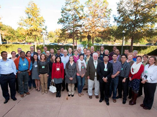
The Southeast Climate Consortium (SECC) held its fall planning meeting November 13-15 in Gainesville, FL, at the University of Florida. The SECC is one of the Regional Integrated Science and Assessment projects sponsored by NOAA's Climate Program Office. Florida State University, including the Florida Climate Center, is one of the eight partnership universities in the Southeast. The SECC aims to perform research and applications that further the use of climate information and forecasting in agriculture, forestry, water resource management, and other terrestrial ecosystems. The fall planning meeting is an opportunity to share progress on current projects and strategize on continuing and proposed new opportunities. State Climatologist David Zierden attended the meeting and presented a summary of recent climate patterns and the outlook for the upcoming winter and spring seasons.

|
|
Asst. State Climatologist Out in Local Community
In early November, Assistant State Climatologist Melissa Griffin traveled to a local Tallahassee elementary school and helped judge their annual science fair. Students from kindergarten to 5th grade participated in the school event, submitting a variety of well thought out and unique experiments.
The Thursday before Thanksgiving, Ms. Griffin gave eight 30-minute presentations to 4th and 5th grade students at a Wakulla County elementary school. Her talk covered the basics of weather to complement the school's weather, climate and water cycle science curriculum. On the same day, she also gave a talk to the local chapter of the American Meteorological Society/National Weather Association on the importance of climatology and applied climatology.
The next day, Ms. Griffin gave a special lecture on Climate Change and Variability in Florida to one of the Introduction to Meteorology classes on the campus of Florida State University. Ms. Griffin discussed the El Nino Southern Oscillation (ENSO), the recent report released by the International Panel on Climate Change (IPCC) and general climate information from a variety of places across the state.
|
|
Upcoming Events
December 5-6, 2013:
Alabama Farmers Federation Annual Meeting in Montgomery, AL
December 10, 2013:
Extension Winter Weather School in Tavares, FL
January 13-17, 2014:
4-H Youth Development Institute Conference in Ocala, FL
January 25, 2013:
Children's Day at the Museum of Florida History in Tallahassee, FL
February 2-6, 2014:
94th Annual Meeting of the American Meteorological Society in Atlanta, GA
February 22, 2014: FSU High Magnetic Field Lab Open House in Tallahassee, FL
|
|
Example Data Request
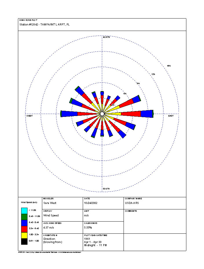
In November, there were a variety of requests asking for wind speed and direction data. One request in particular came from a contractor who was interested in the maximum wind speeds recorded at locations in central Florida during the last 10 years. His interest was in winds that were not associated with landfalling tropical storms or hurricanes, but in the winds that would be typically seen with passing cold fronts or thunderstorms. In addition to the data on maximum wind gusts, he also requested information, for those same locations, about prevailing wind directions and accompanying wind speeds.
 | | Example of a wind rose for the Tampa area. |
|
|
About Us
The Florida Climate Center is part of a three-tiered system of national, regional, and state climate offices, including NOAA's National Climatic Data Center and the Southeast Regional Climate Center. The Florida State Climatologist and other staff at the Florida Climate Center provide the following information and services to the people of Florida:
À Climate Data:
Historical weather observations for weather stations throughout the state of Florida. We are able to provide data for most stations from 1948-present.
À Climate Information:
Long-term historical averages for various stations, climate divisions, and the entire state.
À Extreme Event Records:
Information and analyses on extreme events such as freezes, droughts, floods and hurricanes.
À Special Analysis:
With their vast knowledge of El Ni±o, La Ni±a and climate variability, the State Climatologist and staff can offer expert insight into Florida's climate trends.
À Outreach:
Activities, presentations, and workshops that inform and educate the people of Florida about current and emerging climate issues. We also coordinate volunteers for the Community Collaborative Rain, Hail & Snow Network (CoCoRaHS).
More About Us
|
|