|
Real-time streaming aerial video imagery services can help with post-storm damage assessment and recovery operations
Using a real-time streaming video imagery service immediately following a natural disaster can significantly help your emergency response field teams to efficiently direct their limited resources to the areas hardest hit and safely guide them around debris fields and other obstacles. If the 3G/4G networks go down, with advance notice and a signed service agreement, our alternate communication solution will allow you to continue transmitting visual data to your teams.
These services are available upon request
As of this writing, we have enough advance warning to stage our aircraft and flight crews outside the immediate path of the storm so that we can be on scene as soon as the storm has passed and it is safe to fly. Our operational teams are currently scheduling their deployment areas.
If you want to be included in our prestorm planning, please contact our Aviation Operations Director, Rick Bartle or Chief Pilot Richard Jackson (see contact information below), to be sure the proper contract documentation is in place. Having a signed disaster recovery agreement in place with us prior to the event allows you to receive 75% reimbursement of your post-storm recovery costs from FEMA.
 | | ASSIST-U.S.® Natural Disaster Response |
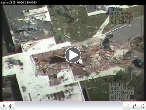
This video, "Natural Disaster Response," provides an example of what our services can offer you, showing before and after views of last year's Springfield, MA, tornado damage area and the Vermont flooding from Hurricane Irene.
View other examples of our post-storm damage assessment footage on our YouTube Channel (see link below) and on our website.
| 


