|
|
|
Hey there! EE Publishers is using Twitter...
 Twitter is a free service that lets you keep in touch all the latest news and receive "The best from EE Publishers" through the exchange and sharing of quick, frequent short messages and links. Join today to start receiving our tweets on your dektop PC, notebook PC or mobile... (more) Twitter is a free service that lets you keep in touch all the latest news and receive "The best from EE Publishers" through the exchange and sharing of quick, frequent short messages and links. Join today to start receiving our tweets on your dektop PC, notebook PC or mobile... (more)
|
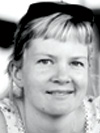
The road ahead for South Africa's homegrown address standard
by Serena Coetzee, University of Pretoria
 SANS 1883, Geographic Information - Addresses, SA's address standard was officially launched on 15 Oct 2009. The aim of the address standard is not to devise a new system of addressing nor to build a national address database, but rather to enable interoperability in address data, which will facilitate the allocation of addresses and the use of address data... ( more) |
Mapping the world-class African city
by Heather Ford, social entrepreneur
 The City of Johannesburg is closing off its GIS data in a "cost recovery" move that other South African municipalities are set to follow. This, say some industry players, is not in keeping with Joburg's plans to become "a world-class African city". The closed data approach is being questioned in countries around the world, where closed data policies... ( more) |
Is geospatial data free?
by Marcelle Hattingh, Corporate GIS
 There is no such thing as "free" data. Someone in the data value chain pays for it. Data has to be sourced or collected, stored, maintained and packaged appropriately for its use to be maximised and this carries a cost. It is expensive to capture and maintain high quality geospatial data that is accurate, current and fit for use... ( more) |
Archaeology: Combining mapping techniques with digital technology
by Laura Scheiber and Maureen Boyle, Indiana University, and Judson Finley, Northwest College
By combining traditional mapping techniques with digital technology, archaeological researchers aim to provide a comprehensive package for understanding domestic space and everyday lives. Data from individual Tipi rings reveal information about past economic and social organisation, domestic and ritual use of space, and worldview... ( more) |
|
Monitoring surface displacement in three dimensions
Information from Tilt-Tech
After several unseasonably heavy rainstorms, a 105 hectare landslide occurred at Trapper Coal Mine in northwest Colorado. In some areas, the slide displaced ground more than 122 m. Several mineable coal seams are located beneath the slide zone. If the slide were to reactivate, by natural catalysts and/or mining activity, loss of life and equipment would be devastating... (more) |
GIS in contaminated site investigations and remediation planning
by Vierah Hulley, Sasol Technology
The use of environmental geographical/geospatial information systems (GIS) is fast gaining momentum in South Africa. One of the useful applications of this tool is in combining multiple lines of evidence in the decision-making process on the outcome of site investigations. As legislation becomes increasingly stringent regarding responsibilities for contaminated site assessments and remediation... (more) |
|
Using GIS in biodiversity conservation across South Africa
by BGIS Project Team
Unlike traditional geospatial information systems that rely only on an orthogonal, or top-down view of an area, Pictometry captures images obliquely, i.e. from an angle, and creates a more natural three-dimensional view so that users can see land features and structures clearly and in their entirety. With only minutes of training, a new user can access detailed imagery of a region and learn to navigate quickly and easily... (more) |
Spatial optimisation of the SA Social Security Agency service offices
by Larry Zietsman, Geographical Systems Research Bureau, and Cobus van Doorn, SITA
The South African Social Security Agency (SASSA) strives to provide an optimal service of social benefits and welfare grants to the population of South Africa. One of the areas identified by SASSA for improvement relates to public accessibility to its service office locations and the services rendered at these points... (more) |
A new way to 3D scan
by Alan Walford, Eos Systems
Do you need to create dense 3D point clouds and detailed surface models of physical objects, and do you want to do it in a cost-effective and efficient manner? A new class of 3D scanning technologies, called photo-based scanning, may be the solution you are looking for... (more) |
The best GNSS application innovations of 2009
Information from Application Centre for Satellite Navigation Oberpfaffenhofen
This year's European satellite Navigation Competition saw eight special topic prizes and 17 regional honours awarded along with a €20 000 grand prize. The grand prize winner of the 2009 European Satellite Navigation Competition, Osmógrafo, combines satellite positioning with wind measurement and rescue dogs' sense of smell in order to better determine which areas have already been covered by search teams... (more) |
GNSS and InSAR technology applied to the hydrological cycle
by CJH Hartnady and A Mlisa, Umvoto Africa
Modern space-geodetic methods of high precision and accuracy were developed because of the benefits that they could bring to geophysics, and now have broad application to almost all branches of geophysics. Geodetic measurement systems involving GNSS and/or InSAR methods are particularly valuable to scientific investigations of the water resources... (more) |
Rally monitoring equipment for timing, route and safety tracking
Information from Instrotech
Most of you have seen rally cars racing at high speed on country roads with clouds of dust, through forests, rivers and across deserts. Ever wonder how the timing, route monitoring and safety tracking are done?... (more) |
|
Views, comment and opinion
|
|
Industry and institute news
| |
|
|
|
|
|
(Flash flip-page edition)
(Flash flip-page edition)
(Flash flip-page edition)
|
Published by
EE Publishers
P O Box 458
Muldersdrift
1747
South Africa
Tel 011 543-7000
Fax 011 543-7025
|
|
EE Publishers
All rights reserved | |